


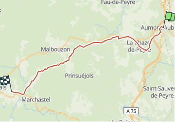

18,6 km | 24 km-effort


Utilisateur


Application GPS de randonnée GRATUITE
 SityTrail
IGN / Instituts géographiques
SityTrail World
Le monde est à vous
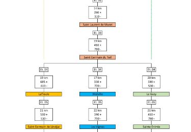
Randonnée de 24 km à découvrir à Occitanie, Lozère, Peyre en Aubrac. Cette randonnée est proposée par jac.briand@hotmail.fr.
Marche
Marche

Marche
Marche
Marche
Marche
Marche
Voiture
Marche